Sign In

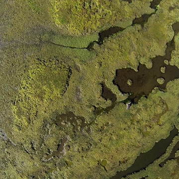
High resolution, geo referenced orthomosaic’s from aerial imagery. You supply the imagery, or we can fly it for you and we can made aerial mosaics that are accurately geo reference and can be created to fit whatever GIS system you work with, or as part of a digital map, with other relevant data that you provide. This is suitable for presentations and documents and also integration with any GIS system that you work with.
For more information on OrthoPhoto processing talk to DTM Technologies
Welcome back to FindTheNeedle.
Not registered? Get listed — most visitors don't have an account yet.
List your company on FindTheNeedle.