Sign In

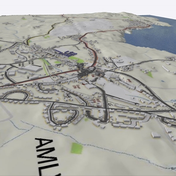
We provide accurate geo-spatial 3D modelling and mapping solutions generated from 2D aerial imagery. Digital Surface Model, High resolution Digital Elevation Model, Orthomosaic and Point Cloud creation or stand alone 3D models from a set of photographs from the ground or from the air.
For more information on Geo-spatial 3D Modelling and Mapping solutions talk to DTM Technologies
Welcome back to FindTheNeedle.
Not registered? Get listed — most visitors don't have an account yet.
List your company on FindTheNeedle.