Sign In

Erosion Monitoring - carried out by S J Geomatics throughout the UK.
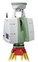
By using 3D laser scanning can save you time and money on all types of Erosion Monitoring; a single surveyor can collect millions of extremely accurate data points in a short time, making this an efficient technique.
SJ Geomatics uses state-of-the-art technology to bring you exceptional quality that gives high definition to Erosion Monitoring within your project.
Examples for uses of 3D Laser scanning Surveys
Erosion monitoring, Underground service mapping, Ductwork Surveys, Pipework Surveys, Bridge Surveys, Road Surveys, Steelwork Surveys, Topographical Surveys and Measured Building Surveys
For more information on Erosion Monitoring talk to SJ Geomatics
Enquire Now
List your company on FindTheNeedle.