Sign In
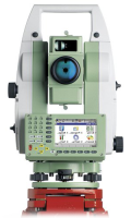
SJ Geomatics ? are licensed to download and copy Ordnance Survey data in-house and issue drawings to clients. Using Leica ? 1200 RTK units, we can give real-time co-ordinates to local or national grid values enabling our clients to use our data for flood risk assessment, allowing immediate decision making based on accurate and instant data.?
For more information on Boundary surveys talk to SJ Geomatics
Enquire Now
List your company on FindTheNeedle.