Sign In


A Comprehensive Guide On Understanding the Basics of CCTV Drainage Mapping and Drain Map Surveys
13-07-2023
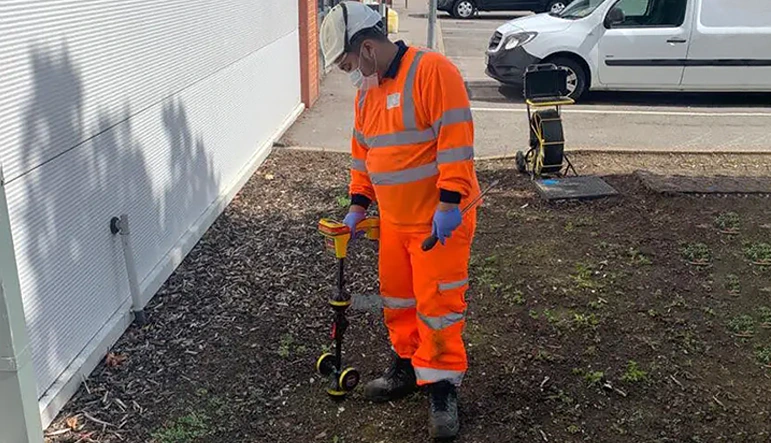
Managing and maintaining a drainage system is a complex task that requires constant monitoring and attention. The use of advanced technology, such as CCTV drainage mapping and drain map surveys, has significantly improved the efficiency and accuracy of these tasks. In this guide, we will delve into the basics of these technologies, their advantages, and how they are implemented in practical situations.Read on to understand how CCTV drainage mapping and drain map surveys are revolutionizing the management and maintenance of drainage systems. The Importance of Drainage SystemsA drainage system is an essential component of any infrastructure project. It ensures that excess water is safely transported away from properties, preventing waterlogging, flooding, and other related issues. However, managing and maintaining a drainage system is no easy feat. It requires regular inspections and assessments to ensure that the system is functioning efficiently and is free from blockages, leaks, and other problems. Technological advances in drainage system management have made it possible to conduct thorough inspections and assessments with minimal disruption to the environment. One such advancement is the use of CCTV drainage mapping and drain map surveys. What is CCTV Drainage Mapping and Drain Map Survey?CCTV drainage mapping is a process that uses closed-circuit television (CCTV) cameras to inspect and record the status of a drainage system. These cameras are inserted into the drainage network and can travel through pipes and other structures to capture images and videos of the system’s interior. This information is then analyzed to identify any issues or potential problems within the drainage system. On the other hand, a drain map survey is the process of creating a comprehensive and detailed map of the drainage system using the information gathered from the CCTV inspection. This map can provide a clear and accurate representation of the drainage network, highlighting any blockages, defects, or other concerns that may require attention. Advantages of CCTV Drainage Mapping and Drain Map SurveyThere are numerous benefits of using CCTV drainage mapping and drain map surveys for managing and maintaining a drainage system. Here are some of the biggest advantages of this service: Accuracy and efficiency: With CCTV cameras capturing high-quality images and videos of the drainage system’s interior, it becomes easier to identify and assess any issues or potential problems. This method provides a more accurate and efficient way to inspect and maintain the drainage network compared to traditional methods.
Non-invasive: One of the greatest advantages of using CCTV drainage mapping and drain map surveys is that they are non-invasive. There is no need to excavate or cause any disruption to the surrounding environment, making the process quicker, cheaper, and less disruptive.
Comprehensive information: A drain map survey provides detailed information about the entire drainage network, including the location and condition of pipes and other structures. This information can be crucial for effectively managing and maintaining the system and can be an invaluable tool for planning future improvements or expansions.AdvantagesCCTV Drainage MappingDrain Map SurveyAccuracy✓✓Efficiency✓✓Non-invasive✓✓Comprehensive information✓✓What to Look for in a CCTV Drainage Mapping and Drain Map SurveyQuality of CCTV InspectionWhen conducting a CCTV drainage mapping project, it is crucial to ensure that the CCTV camera being used is capable of capturing high-quality images and videos. The resolution and clarity of the visual data gathered will directly impact the accuracy and effectiveness of the subsequent drain map survey. Expertise of the Survey TeamThe team conducting the drain map survey should have extensive experience and knowledge in drainage system management and maintenance. They should be able to analyze the information gathered from the CCTV inspection and create a detailed and accurate map of the drainage network. Comprehensive Drain Map SurveyA thorough drain map survey should provide information on the location, size, shape, and condition of all pipes and structures within the drainage network. It should also identify any blockages, defects, or other issues that may require attention. When to Use CCTV Drainage Mapping and Drain Map SurveyCCTV drainage mapping and drain map surveys can be used in a variety of situations to manage and maintain drainage systems effectively. Here are some of the common situations in which you would use mapping services: Routine maintenance: Regular inspections using CCTV drainage mapping can help identify any issues or potential problems within the drainage system before they become major concerns. This can help ensure the efficient functioning of the system and reduce the risk of costly and disruptive pipe repairs.
Before and after construction projects: It is essential to assess the condition of a drainage system before and after any construction projects, such as building expansions or infrastructure improvements. CCTV drainage mapping and drain map surveys can provide valuable information about the impact of the construction work on the drainage network and help identify any potential issues that may need to be addressed.
Environmental assessments: In some cases, drainage systems may be subject to environmental assessments, such as those required by planning authorities or regulatory agencies. CCTV drainage mapping and drain map surveys can provide the necessary information to demonstrate compliance with environmental regulations and identify any areas of concern. Implementing CCTV Drainage Mapping and Drain Map SurveyHere are some crucial steps to ensure a successful CCTV drainage mapping and drain map survey project:
Selecting the right equipment: Using high-quality CCTV cameras and software is essential for capturing clear and accurate images and videos of the drainage system’s interior. The chosen equipment should be suited to the specific requirements of the project, taking into account factors such as pipe size, accessibility, and environmental conditions.
Training and expertise: The team conducting the CCTV inspection and drain map survey should have sufficient training and experience in drainage system management and maintenance. This is crucial for ensuring that the gathered information is accurately analyzed and that the resulting drain map is a true representation of the drainage network.
Regular updating: Drainage systems are subject to change over time, and it is essential to keep the drain map up to date to reflect these changes. Regularly updating the map can help ensure that it remains a valuable tool for managing and maintaining the system effectively. Why Should You Use CCTV Drainage Mapping?CCTV drainage mapping and drain map surveys are powerful tools for managing and maintaining a drainage system. By providing accurate and comprehensive information about the condition and layout of the drainage network, these technologies can help identify issues, plan improvements, and ensure the efficient operation of the system. By understanding the basics of these technologies and implementing them effectively, drainage system managers can ensure the long-term health and performance of their networks while minimizing disruption and environmental impact.
Don’t Leave it To Chance!
Book Our Drain Mapping Service TodayMake sure you avoid disruption, damage, and delays to your building project. Get a free fixed-price quotation.
Call 0800 612 8038
For more information on A Comprehensive Guide On Understanding the Basics of CCTV Drainage Mapping and Drain Map Surveys talk to Drain 247
Enquire Now
More Blogs
List your company on FindTheNeedle.